

In construction, architecture and urban planning, the smallest mistake can lead to massive issues. Whether you’re building a residential neighbourhood, planning a commercial complex or designing a public infrastructure project, accurate site data is paramount. Topographical surveys provide that data, mapping the land’s features in detail to ensure that construction projects go smoothly and efficiently. Without precise topographical data, you risk costly delays, design errors and even safety concerns.
In this article, we’ll explore the significance of topographical surveys, how they enhance the design and execution of projects and why every engineering firm, architect and developer should prioritise them.
Why Topographical Surveys Are Crucial for Every Build
Topographical surveys are more than just a tool. They are the foundation of every successful construction project. These surveys create a detailed map of the natural and man-made features of the land, including elevations, contours, vegetation, water bodies, roads and utilities. Real Property Management Prestige Group notes that whether you’re building on an untouched plot or an existing site, having this data ensures that your designs fit the land’s natural features.
Without proper survey data, your designs may not align with the landscape. As a result, engineers could face unexpected terrain obstacles, architects might design buildings incompatible with the site and developers may need to adjust or abandon projects at great cost.
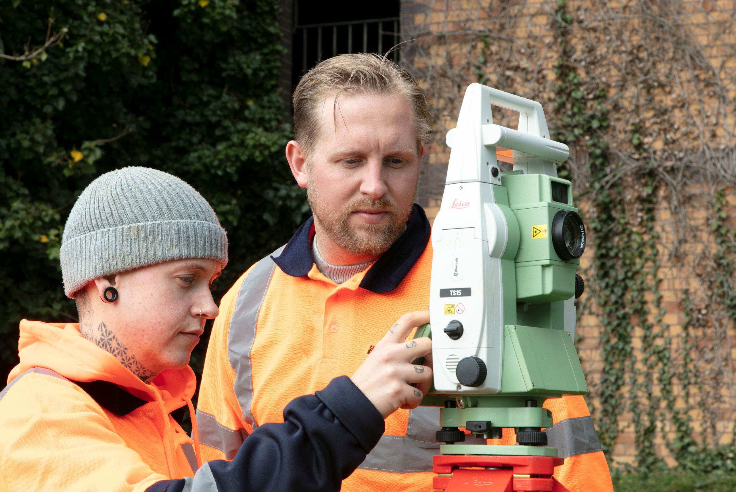
The Process of Conducting a Topographical Survey
A topographical survey is conducted using a combination of field measurements and advanced technology to map the land. It creates reliable, accurate data that serves as the bedrock for your project’s success. Here’s how the process typically works:
- Site Visit: Surveyors visit the site to gather data on land features. This can involve traditional tools like theodolites and levelling instruments or advanced technology like LiDAR (Light Detection and Ranging).
- Data Collection: Surveyors measure and record the land’s elevation and contours, identifying key features such as existing structures, natural slopes and roads.
- Survey Analysis: After data collection, the results are analysed to create a digital model or map of the site. This model can be used for 2D or 3D visualisation, which is integrated into the project’s planning and design phases.
- Reporting: The survey is compiled into a report that includes maps, charts and other visual aids to help engineers and architects make informed decisions.
How Topographical Surveys Support Planning and Design
For engineering firms and architects, the importance of topographical surveys cannot be overstated. They provide the data required to make critical decisions during the design phase and throughout the construction process. Here’s how they contribute to each stage:
- Design Compatibility: Topographical surveys ensure that design elements, such as foundations, utilities and drainage, are planned in line with the land’s natural features. This reduces the risk of design errors and avoids costly reworks.
- Risk Mitigation: By identifying terrain challenges, such as steep slopes or water bodies, surveys allow architects and engineers to adjust their designs to prevent issues such as flooding or instability.
- Regulatory Compliance: Many construction projects require approval from local authorities. Topographical surveys help ensure that your designs meet zoning laws and environmental regulations.
- Cost Efficiency: Precise survey data allows developers to plan efficiently, minimising material waste, reducing unforeseen costs and avoiding costly project delays.
Benefits of Topographical Surveys in Construction
Incorporating topographical surveys into your planning process offers several significant benefits:
- Informed Decision Making: Having accurate, real-time data ensures that decisions are based on facts rather than assumptions, leading to more effective designs.
- Enhanced Accuracy: With detailed survey data, construction teams can measure precisely where structures should be built, resulting in better alignment and smoother construction processes.
- Reduced Errors: Topographical surveys reduce the likelihood of on-site errors. For example, if the land is prone to flooding, the survey can alert engineers early, allowing them to incorporate solutions in the design phase.
- Increased Safety: By understanding the topography of the site, developers can avoid building in unsafe areas, ultimately reducing risks during and after construction.
Real-World Example: Topographical Surveys in Action
Consider a project in a densely populated urban area where the developer plans to construct a multi-storey office building. The topographical survey reveals significant underground infrastructure, including old sewer lines and electrical cables.
Without this data, construction could have disrupted vital services or led to costly rerouting. The architect and developer adjusted the plans to avoid these obstacles, saving time and money by understanding these complexities early in the design phase.
Key Technologies Used in Topographical Surveys
The field of topographical surveying has evolved significantly with advancements in technology. Here are some of the latest innovations in the field:
- LiDAR (Light Detection and Ranging): A laser-based technology used to scan and create 3D models of the land. LiDAR provides extremely accurate results, even in hard-to-reach areas like dense forests or steep slopes.
- GPS Surveying: GPS technology allows surveyors to capture precise location data, providing a more efficient and accurate alternative to traditional measurement techniques.
- Drones: Drones equipped with cameras and LiDAR technology can conduct surveys over large areas quickly and safely, providing real-time data and aerial views of the site.
- GIS (Geographic Information Systems): GIS software allows surveyors to analyse and display survey data on maps, creating visual representations of the land and helping project teams make data-driven decisions.
Topographical surveys have become faster, more accurate and more comprehensive, offering better insights for the planning and execution of complex projects by using these cutting-edge tools.
The Future of Topographical Surveys
As technology continues to advance, the future of topographical surveys looks promising. Automation and AI are poised to improve data collection processes, while virtual and augmented reality tools will enable even more accurate simulations and project visualisations. This will allow engineers, architects and planners to collaborate more effectively, speeding up project timelines and improving outcomes.
Why You Should Prioritise Topographical Surveys in Your Projects
Time and accuracy are everything in construction. Topographical surveys provide the detailed, precise data necessary to make informed, cost-effective decisions that keep projects on track. Whether you are designing a new residential area, planning a skyscraper or revamping existing infrastructure, this vital data is key to avoiding costly mistakes and ensuring the project’s success.
Take Action Now for Smarter, Safer Projects
Every successful construction project begins with accurate data and topographical surveys lay the foundation for that data. Whether you are working on a small-scale residential project or a massive commercial development, topographical surveys are a crucial tool in your planning toolkit. Ensure that your next project is built on the right foundation. Invest in topographical surveys today.


